This little feature is one that Google brought to their browser-based Google Maps last year as well as to their Google Maps app. If you are running an unfamiliar route, it can be a great feature to check out before you head out the door! I have been using it for a while but realized I had never written about it!
A Great Google Maps Feature for Runners
Depending on how you look at it, elevation on a run can either be something to fear or an integral part of your training. Either way, it can be difficult to find (or avoid) those hilly spots on an unfamiliar route. Sure, there are places like MapMyRun that can show you the elevation on a route your chart but maybe you just want to head out the door – which way will you go and what will the elevation look like?
Use Google Maps to See Elevation Profiles for Running Routes
To get an answer to that question, just open up Google Maps to see the answer! To see the elevation, you will need to look for the Walking Directions.
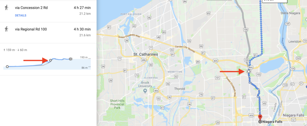
When you put your starting point and then the destination in, select walking directions and it will show you the elevation gain and loss for the route that you are viewing.
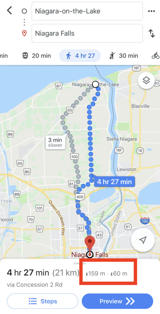
If you use the app, pull up for the details and you will see a graphic of the elevation profile over the course of the directions. This is a huge help as you can actually use this to see the different elevation profiles for the various walking routes available between the two points.
This helps a lot for a couple of reasons – if you want to get in a run at a particular pace, you can choose a run that will not include hills like may be present or you can select a route that will give you some hills if you need to get a good hill workout in.
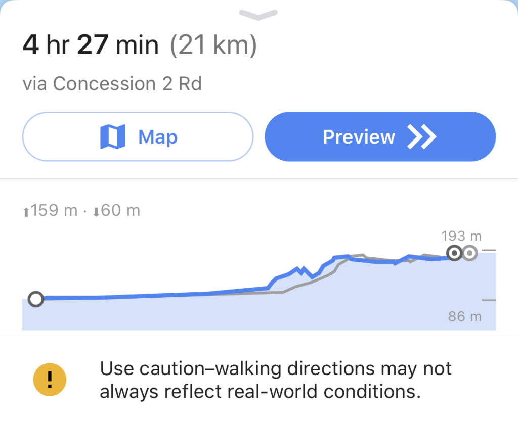
If you use the web-based Google Maps, you can actually see at which point of the route the various elevation points come into play by simply clicking on the elevation profile.
Good for Tourists, Too?
Remember, these are actually walking directions! So, if you are touring a new city, it can be a huge help to know what kind of elevation you have to deal with if you are headed out on foot! In some cases, especially when traveling with young children, you may want to try another transportation option or go a different direction if the elevation is too steep. Knowing this before you go can be a huge help!
Summary
Sure, MapMyRun and others are more built for runners but I often find myself just trying to find the best way between two points. Google Maps and their elevation help has been that aid to me that I needed to see what I could expect out on the run. Hopefully it helps you as well!